Hiking near Hemlock Lake, a Finger Lake
Hiking near Hemlock Lake, a Finger Lake
If your perfect day includes escaping civilization with a hike, then hiking St Michael’s Mission is the perfect place for you. While officially located in Conesus, the spacious grounds of the former St. Michael’s Seminary and latter St. Michael’s Mission are located on the slopes above Hemlock Lake one of the small Finger Lakes.
In the early 1900s, Hemlock Lake had a few cottages and homesteads along the shores of the lake. Small steam ferries traveled the lake bringing passengers and goods to the isolated homes. The City of Rochester obtained Hemlock lake and Candice Lake which is nearby as a water supply and the lands surrounding them. The city did not allow any development around the lake. Today, while some Finger Lakes have limited development, most of the Finger Lakes have sections of heavy development. Conesus Lake, as an example, has homes side by side for almost the entire lake shore. The only buildings around Hemlock Lake is the water authority.
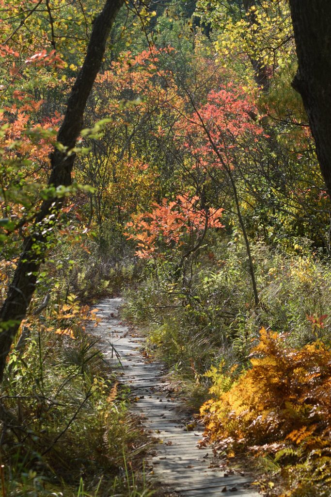
New York’s Finger Lake region is known for the lakes and rolling countryside created during the retreat of the last ice age. The region is within the Allegheny Plateaus which is a portion of the Appalachian Plateau. The area is rural in nature with a number of small towns and villages. Public lands including State and community parks, the Hemlock-Canadice State Forest and the Finger Lakes National forest abound. Hikers can easily find many interesting places year-round for hiking.
Hiking St Michael’s Mission
Over 50 acres of wooded land provides ample space for a leisurely hike. However, the property is overshadowed by the adjacent land. The majority of the property and the main building are on the west side of Mission Road. The east side of the road has the recreation area and that portion of the property adjoin land owned by The Nature Conservancy which merges with the Hemlock-Canadice State Forest.
Mission Road was the start of a trail managed by The Nature Conservancy. That trail started at the edge of the mission’s property and followed a ridge above a ravine to Hemlock Lake, then followed the shore line to the pump house of Eagle Crest Vineyard then up a very steep road to the vineyard. I tried that trail but ended up finding posted no trespassing signs. Talking with the vineyard owner revealed to me that they stopped access to their property because of a dispute with the Nature Conservancy concerning hunting.
St Michael’s Mission- Hemlock Trails
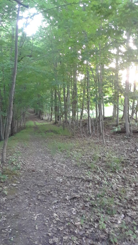
Ok, I just named them that. There are a few nice trails that start on the Mission property and continue on The Nature Conservancy property. Starting at the south driveway of the mission and crossing the road will bring you to the recreational area with a large field and a picnic pavilion. To the right of the pavilion is a wide trail. It follows along the same ravine the old Nature Conservancy trail started with. The trail has just a slight downhill till about .4 miles from the start. Here the trail has a branch to the left and continues straight but starts getting a bit steeper.
Straight ahead
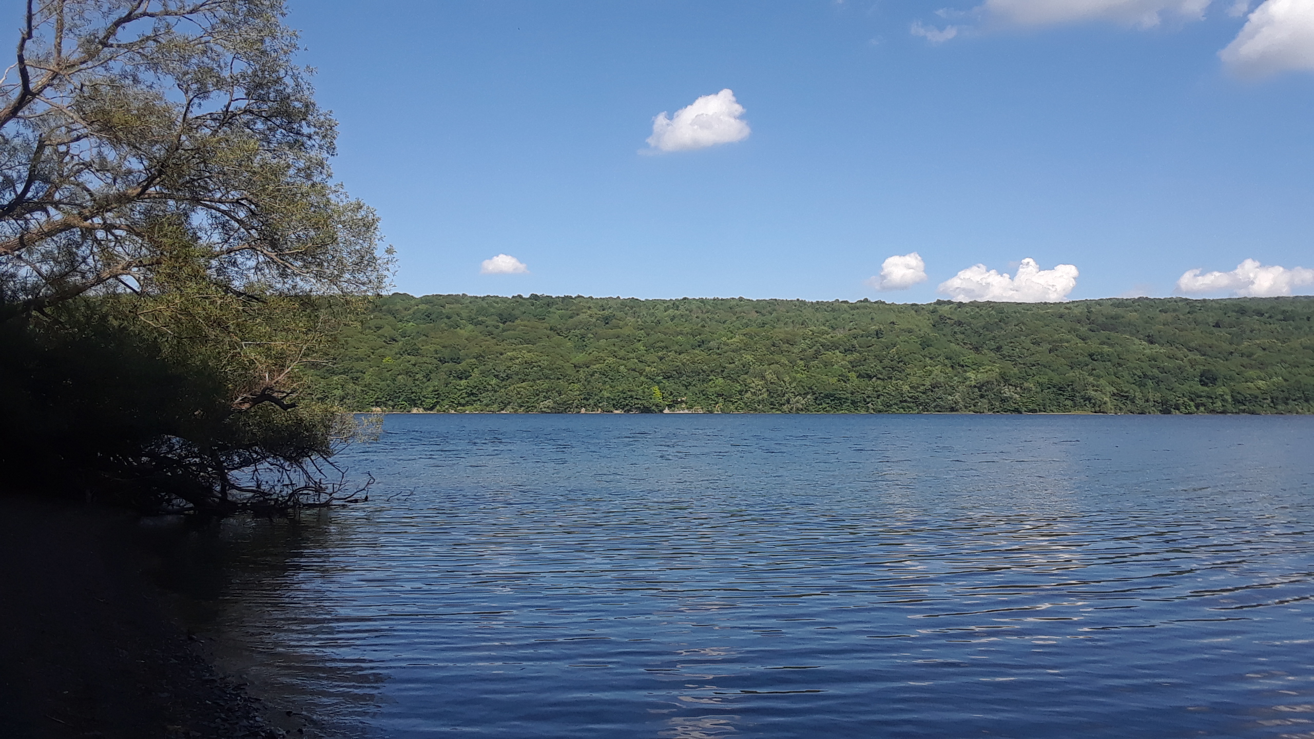
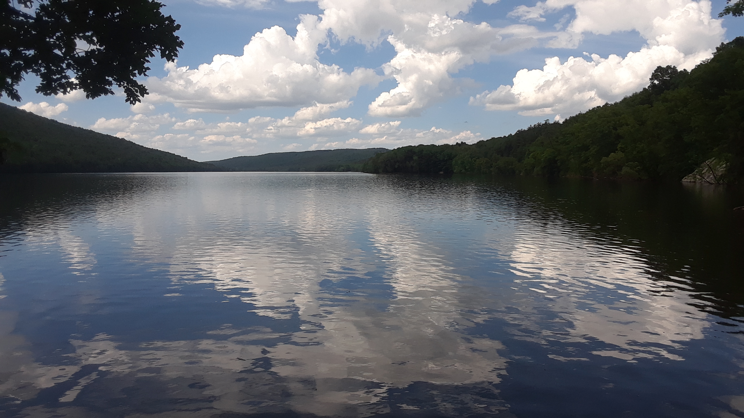
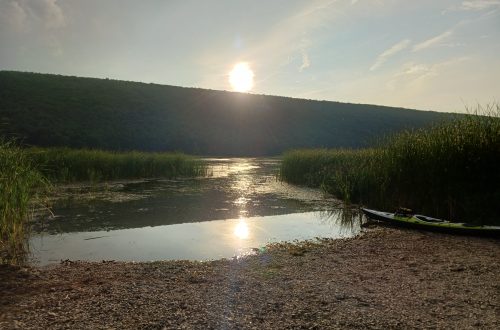
There is a trail from the entrance of the south building to Hemlock Lake which is three quarters of a mile, one and a half-mile round trip plus any walking along the shore. Hiking over that distance there is a 350-foot elevation change. The first .4 miles to the branch sees only a 120-foot change in elevation barely noticeable. The next .3 miles will see a 200-foot change. This is a bit steep but does not require any aids. Just some sure footing going down. The path becomes fairly flat the last few hundred feet from the lake. When you reach the lake, you can walk the shoreline in either direction. The trees are further back on the path to the south.
Find a piece of driftwood to relax on and look out over the lake. It should not belong before you see a fish jumping out of the water or a bird swooping down catching its dinner. If you are lucky, the bird might be an eagle. There are a number of them that make Hemlock Lake their home.
The Loop
A trail that is very nice in the spring and fall is one that I call the loop and is one mile long. In the summer, the grass can narrow the trail making it difficult to pass in a small section. Starting at the mission follow the same route as above until you come to a branch to your left (.4miles). As you turn left, the trail has a gentle slope down. Follow the trail for 500 feet and you will come to a section where there are no tall trees to your left and right. This seems to be an old road or fire break that has been overgrown. If you do not see the break and pass it, you will come to a ravine in about 50 feet. Just turn around and walk back.
Turn uphill at the break and in about a quarter of a mile you will come to an open field with a small stand of trees in front of you. Follow to the right of the trees and it will lead you to the north edge of the recreational field. You can cross the road, climb the steps and walk across the grounds of the Mission. This loop has an elevation change of only 140 feet over a half-mile.
Forest Trails
There will be a separate section for the Hemlock-Canadice State Forest trails, however, there are a few trail heads that are just a short walk from St Michael’s Mission. There are two trail heads off from Mission Road and another off from Blank road, all within one mile.
Forest trail headsThese trails do have an elevation change, however, as they do not go all the way to the lake the change is only between 200 and 250 feet. A good portion of the distance is across the contour, leaving a few steep climbs. There are many streams in the spring time and a number of small waterfalls.
Hemlock-Canadice State Forest Brochure page 2
Hemlock-Canadice State Forest
The Hemlock-Canadice State Forest trails just mentioned are only a few of the many trails around the two lakes.The state maintains about 14 trails in the park. All the trails are natural except the boat launch road which is a seasonal road. A local site has a set of 10 topographic maps that show many of the trails around the lake.
The Reynolds Gully Falls trail is considered by many as one of the best waterfalls trails in the Eastern US. Technically it is outside the state forest and is under the control of the Harriet Hollister Spencer State Recreation Area, however, the parking lot is in the state forest.
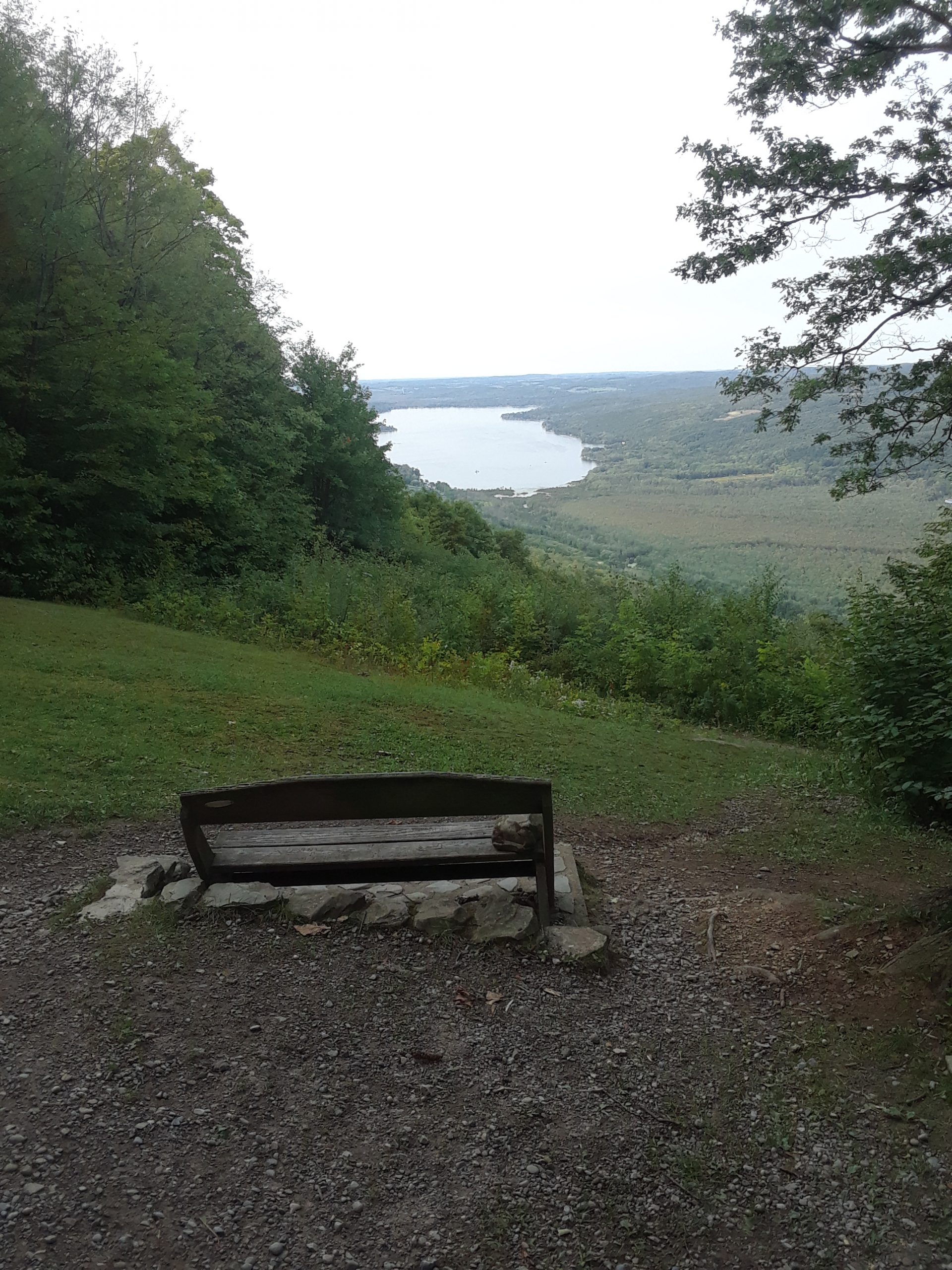
Harriet Hollister Spencer State Recreation Area
Harriet Hollister Spencer State Park is located just South of Honeoye Lake in Canadice, NY. The main park and parking lot is located on Canadice Hill Road where you can find 22.83 miles of multi-use trails for hiking, biking, cross-country skiing, snowshoeing, and a snowmobile route. With an elevation greater than 2,000 feet, the dense woodland receives far more reliable snow cover than elsewhere in the region, making it a prime destination for winter activities.
Other Nearby Finger Lake Hiking Destinations
Here are a few other nearby hiking destinations that are surely worth the short drive.
Letchworth State Park
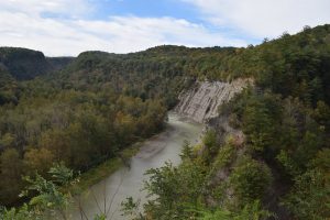
Letchworth State Park, renowned as the “Grand Canyon of the East, is one of the most scenically magnificent areas in the eastern U.S. The Genesee River roars through the gorge over three major waterfalls between cliffs–as high as 600 feet in some places–surrounded by lush forests. Hikers can choose among 66 miles of hiking trails. Letchworth Photos by Charles Davis
The Genesee Valley Greenway State Park
The Genesee Valley Greenway State Park is a 90-mile open space corridor that follows the route of the Genesee Valley Canal (1840-1878) and the Pennsylvania Railroad Rochester Branch (1882-1963) from the Erie Canalway Trail in Rochester’s Genesee Valley Park to the Village of Cuba in Allegany County. The Greenway will eventually extend to Hinsdale in Cattaraugus County.
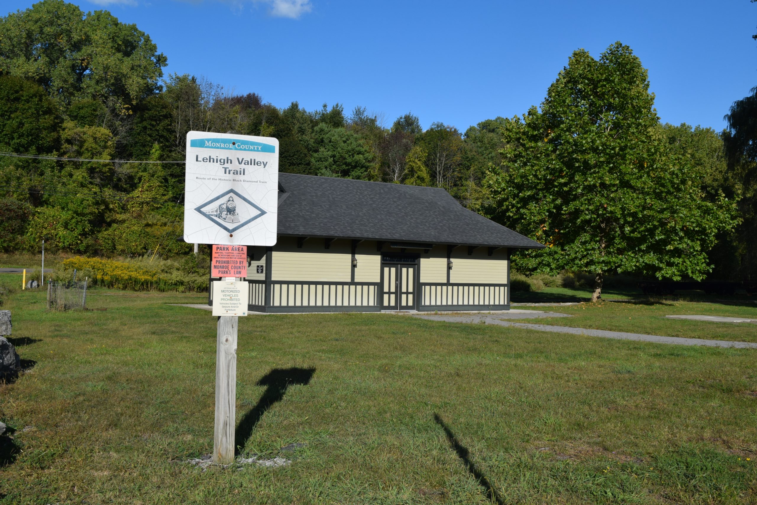
Lehigh Valley Trail Linear Park
This Monroe Country Park is about a 20-minute drive away. It is a trail about 15 feet wide and 15 miles long across the county on the bed of the old Lehigh Valley Railroad. This trail does connect to other trails including the Genesee Valley Greenway State Park.
LVT Brochure 2017
Lehigh Valley Trail North Branch
The old Lehigh Valley Railroad had a north-south branch ending in Rochester. The north branch starts at Rochester Junction and ends in Genesee Valley Park in the City of Rochester.
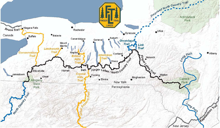
The Finger Lakes Trail System
The Finger Lakes Trail System includes the main Finger Lakes Trail (FLT) from the Pennsylvania-New York border in Allegany State Park to the Long Path in the Catskill Forest Preserve. The main FLT is 580 miles long. There are six branch trails and 29 loop trails and spur trails that extend from the main FLT. These branch, loop and spur trails currently total 412 miles. Including the Main Trail and all branch, loop, and side trails, the Finger Lakes Trail System offers 1,000 miles of hiking.

Mendon Ponds Park
One of my favorites,Mendon Ponds Park is the largest Monroe County Park with 2,500 acres of woodlands, ponds, wetlands and glacially created landforms. In 1969, it was named to the National Registry of Natural Landmarks due to its geologic history and presence of significant kames, eskers, and kettles. Visit the county park page for maps.
The list can go on and on. The variety of hiking trails around the Mission is remarkable and you will find trails for every skill level. If you are looking for relaxing days on the trails, St. Michael’s Mission is a great starting place. Rooms, an entire floor, or a separate building is available on airbnb. See the different listings for St. Michael’s Mission here.
Charles W. Davis
Charles W Davis Jr. is the author of the “Subic Bay Travel and Dive Guide”, the most referenced source of information on the wrecks of Subic Bay. He is also the author of six other diving and travel books and has ghosted written a number of other books. A Freelance writer attracting clients from his own website www.charleswdavisjr.com and working on the upwork website as “Travel & Scuba Diving Specialist Have WIFI, Will Travel”.
One Comment
Charles W. Davis
Additional hiking areas 71 hiking trails around Rochester